Day 4 mileage: 64 Total: 226
Matthew didn’t get the best sleep after hearing Janet’s horror stories around bear spray resistant grizzlies, cougars, and shoulder-less switchback roads. He was able to leave earlier than planned and I set up a meeting spot 15 miles away in Twisp for breakfast.
By bike:
The ride to Twisp was amazing. It was so much fun to see cow pasture and hop fields as well as good foggy scenery. It was also fun to see Lauren get all excited by the scenery.
What I passed the on Washington pass. So glad to be done with it. 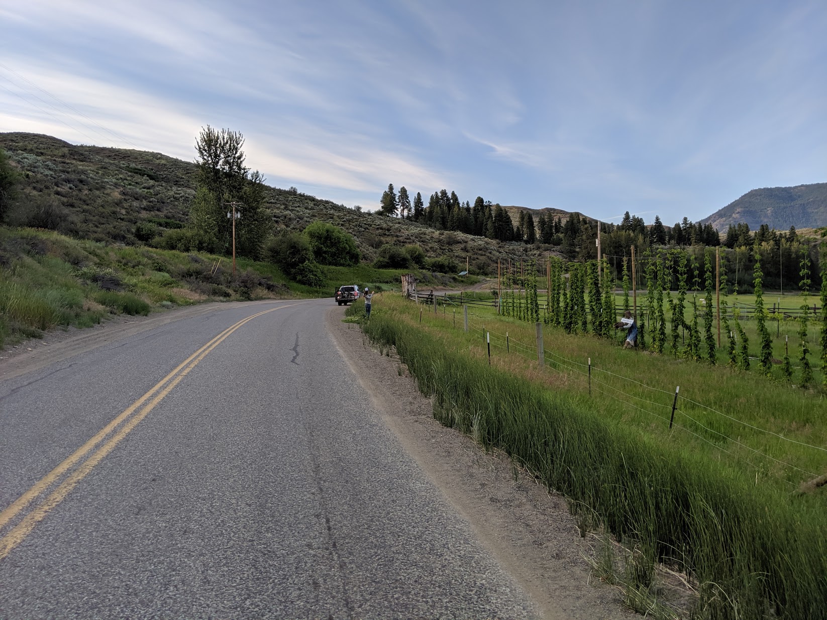
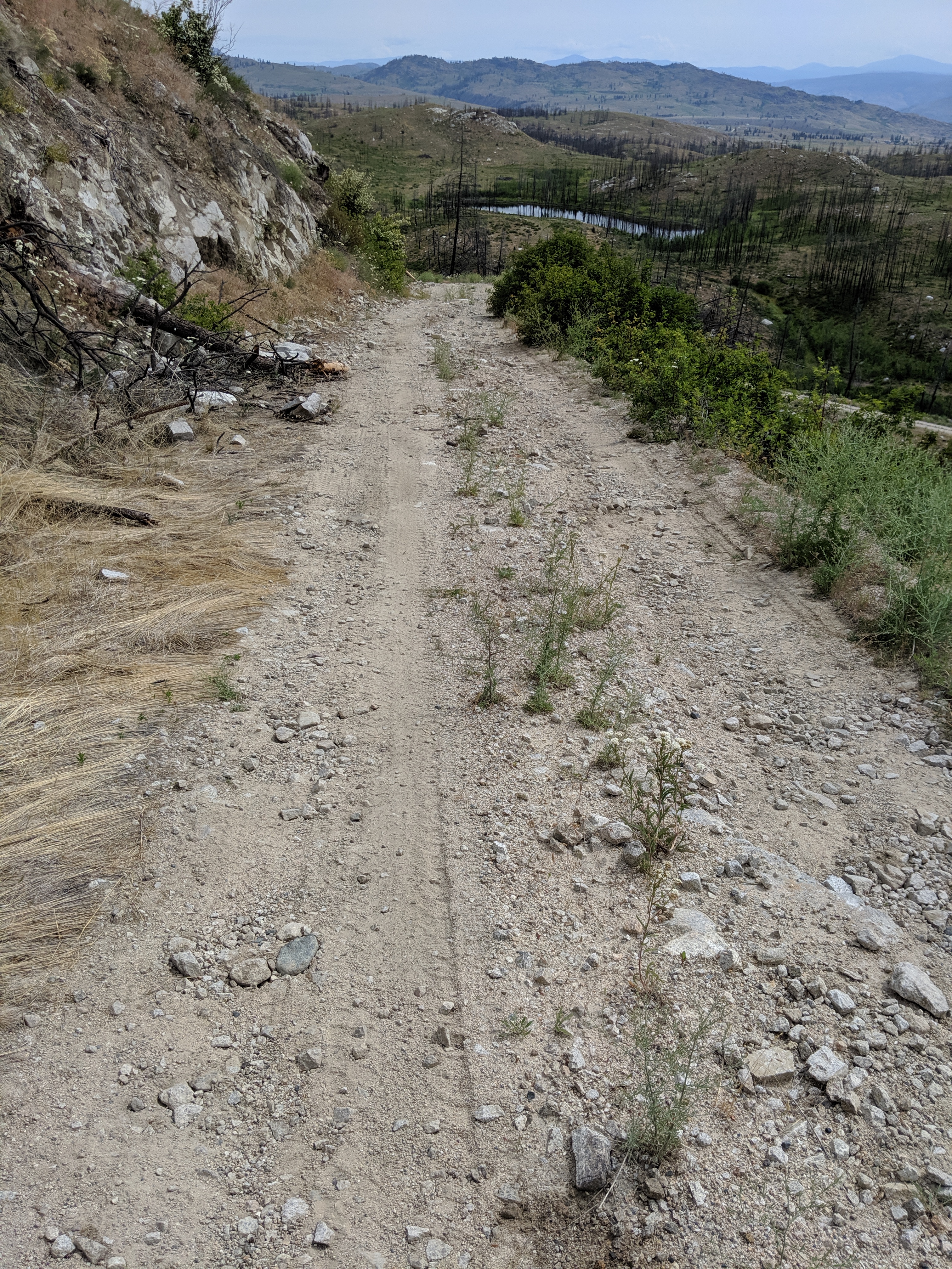
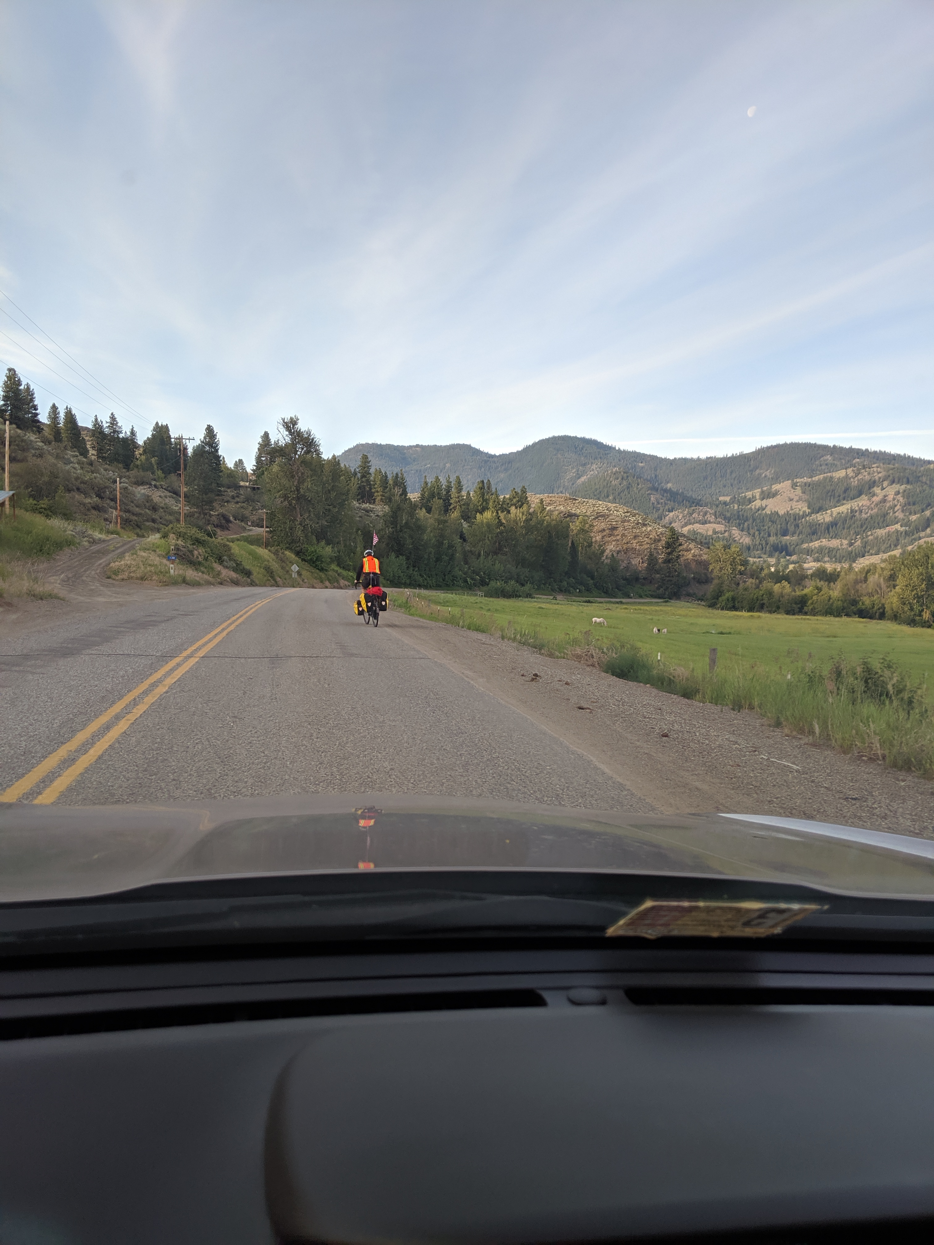
Lauren stopping for photos
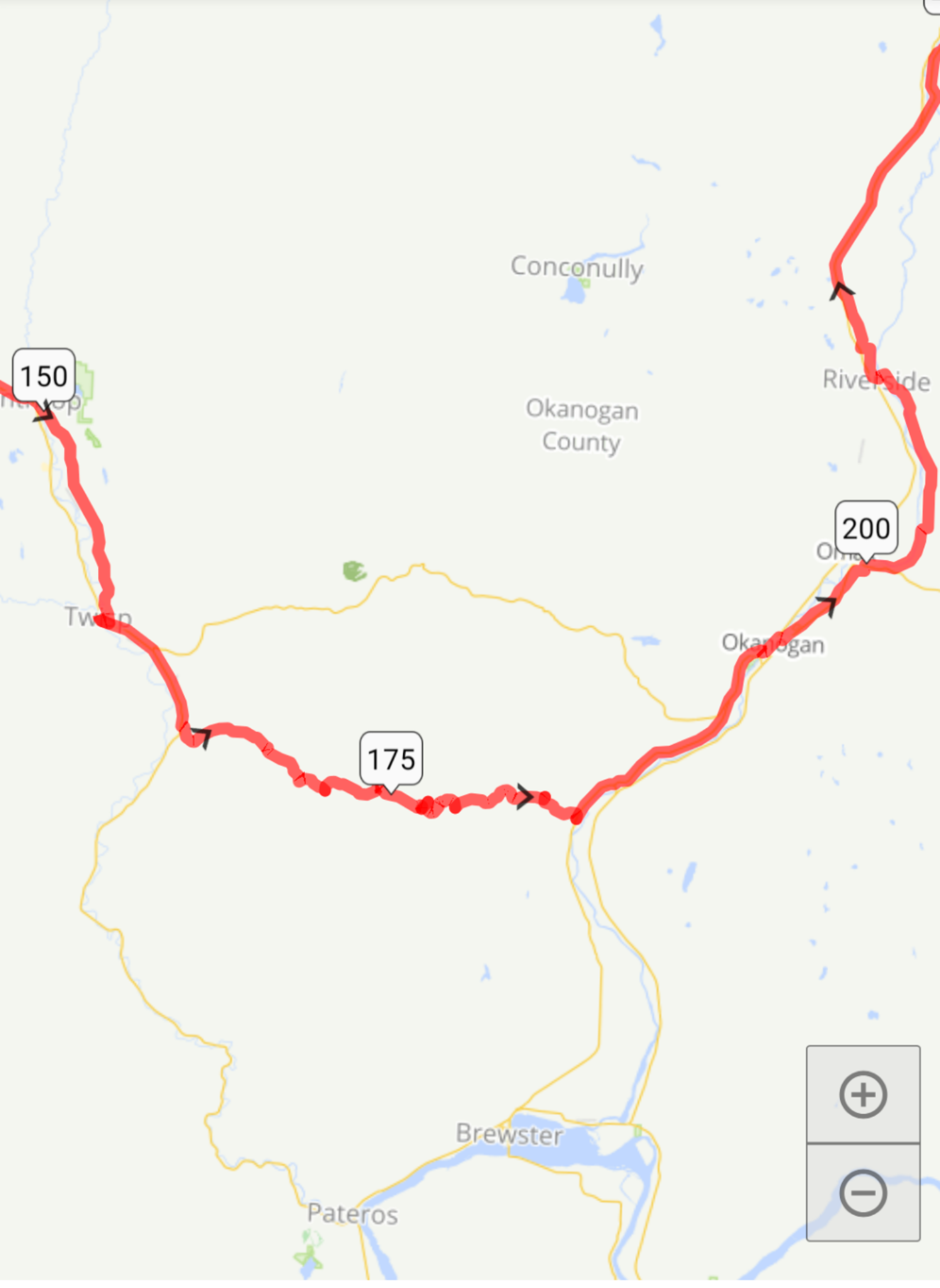
We met up at Twisp for a cinnamon twisp and talked. I was a little nervous because of the ride up loop-loop pass but then realized that the route I stole from ride with GPS was avoiding the 4000 ft incline.
Awesome.
The next 10 miles were just as scenic as I passed by farmland and pretty much nothingness with deer and cows.
Then I hit a dirt road that said “Entering Okanogan National Forest.”
I was wrong.
The beginning of Hell.
“Great! I’m avoiding the pass. A short dirt road and away we go!” I thought.
I went constantly sliding up roads at 3 miles and hour. Skidding and going all over the place. I was scared to death of bobcats so never took but 2 breaks to pick some flowers. Switchbacks galore. I pushed through until I found route 41 and screamed “PAVED ROAD!”
Two miles farther and the alternate route this lady made I soon realized was just planned, not actually ridden, as it told me to veer right down an unmaintained fire road with fallen trees and huge rocks. I made the biggest mistake of the trip.
Three miles down hill I hit a large sign that said:
“PRIVATE PROPERTY
NO HUNTING
NO CAMPING
NO TRESPASSING.”
I sure as hell was not going back up that mountain. I called Lauren to NOT follow me, picked up my bike, and pushed it over the barbed wire and trespassed.
The road got so much worse. Unmaintained, boulders, steep inclines with precipes. I wish I took more pictures but at that moment I was in a total panic. It never ended. I would drive into sandpits and have to push my bike through and up a hill. My prepatellar bursitis got out of control but I didn’t want to get shot by Bubba either. I even had to push my way through cattle herds. I would scream “MOO. FUCKING MOO!!!” as I pushed through.
The picture doesn’t do it justice 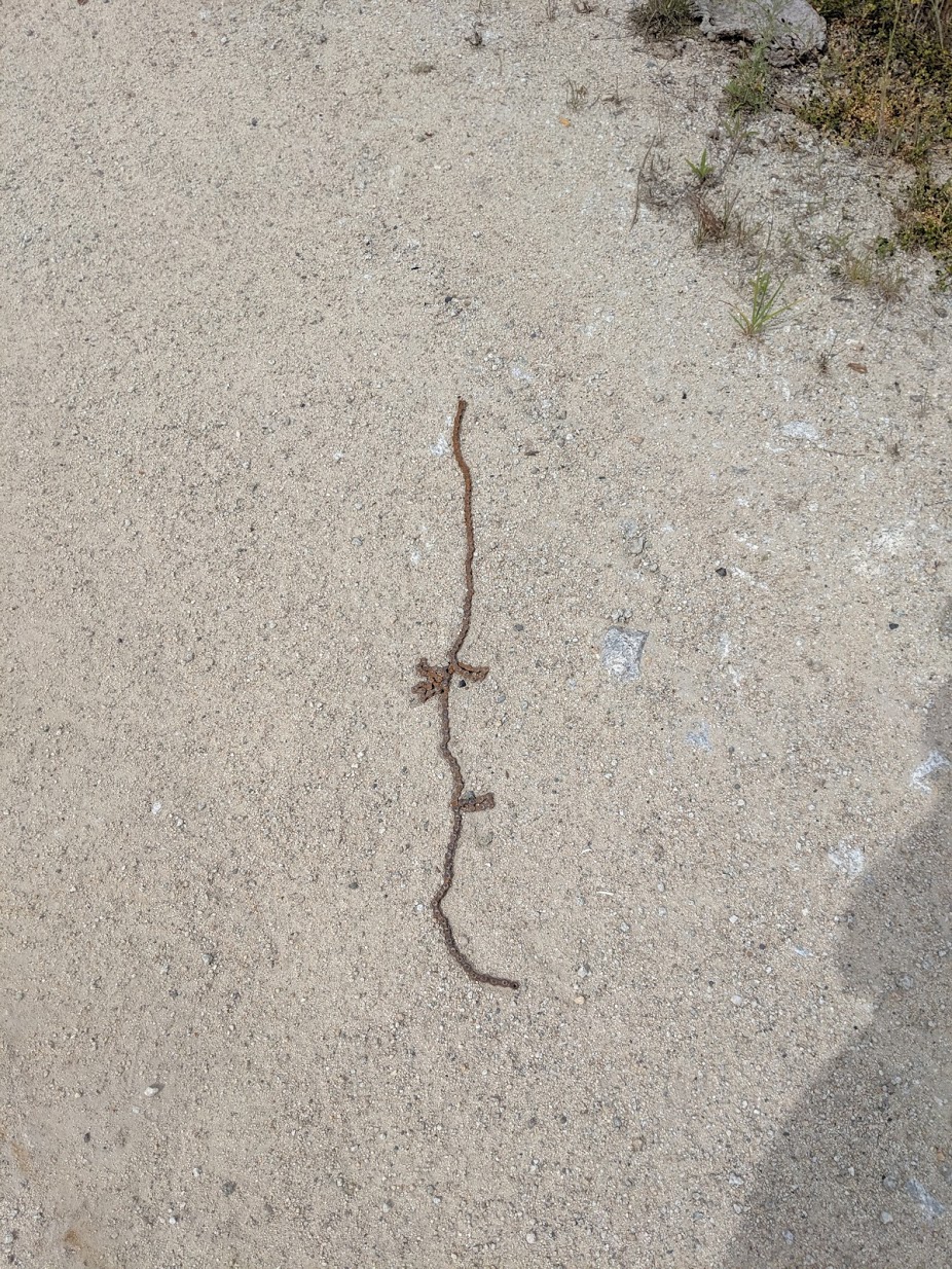
A rusty bike chain, the only remains of another lost traveler.
To make a long story short. I made it and didn’t see a soul the entire time. A lot of burnt trees but I never felt so alone and abandoned in my life.
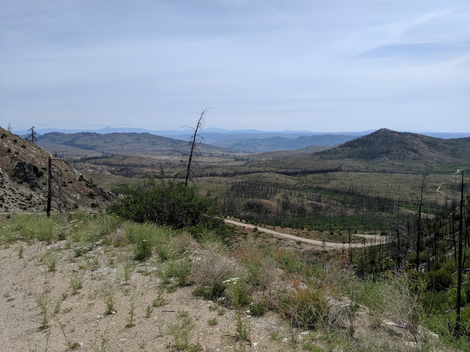
The Final Frontier
The first house I saw I noticed a lady watering her garden, carrying on like nothing happened. Something did happen. I had petechiae on my hands from my hands bouncing on the handlebars so much.
Lauren saw me once I got on the pavement and we both had an emotional moment over local strawberries and Clif Builders Bars.
After getting to paved roads I blasted at 15 mph to Omak. Once I hit the Colville Indian Reservation I bonked and biked in at 2 mph to Margie’s RV park and felt super old. I couldn’t even move as all the ATP had been depleted trespassing frontier property and skidding up dirt roads avoiding cougars.
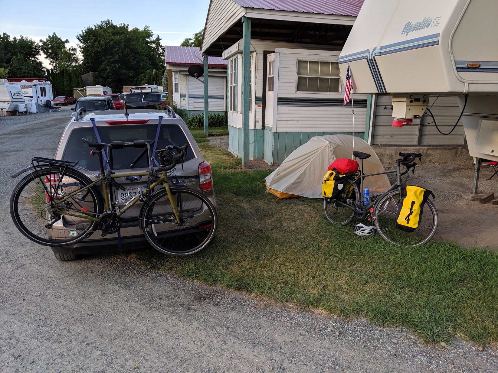
My final resting place at Margie’s RV park
By car:
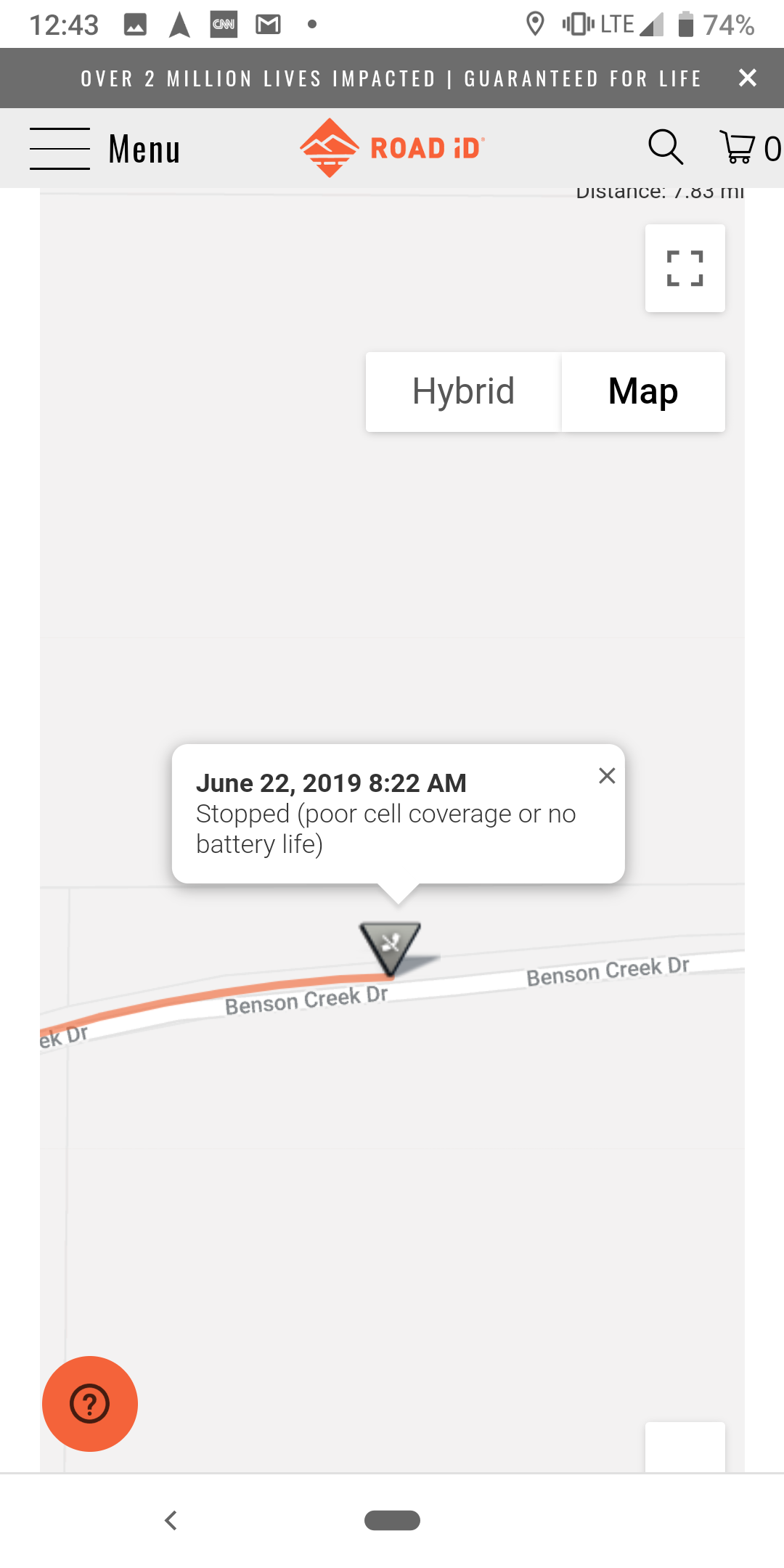
I found an app that runners/cyclists can use to share their location while they’re out and had Matthew download it. It’s called RoadID. It would alert me when Matthew started his ride and I could see his most recent location. It also sends alert when he’s stationary for more than 5 minutes, but this often goes ignored because I know he’ll be taking breaks. This only works if you have service, which became an issue later in the day.
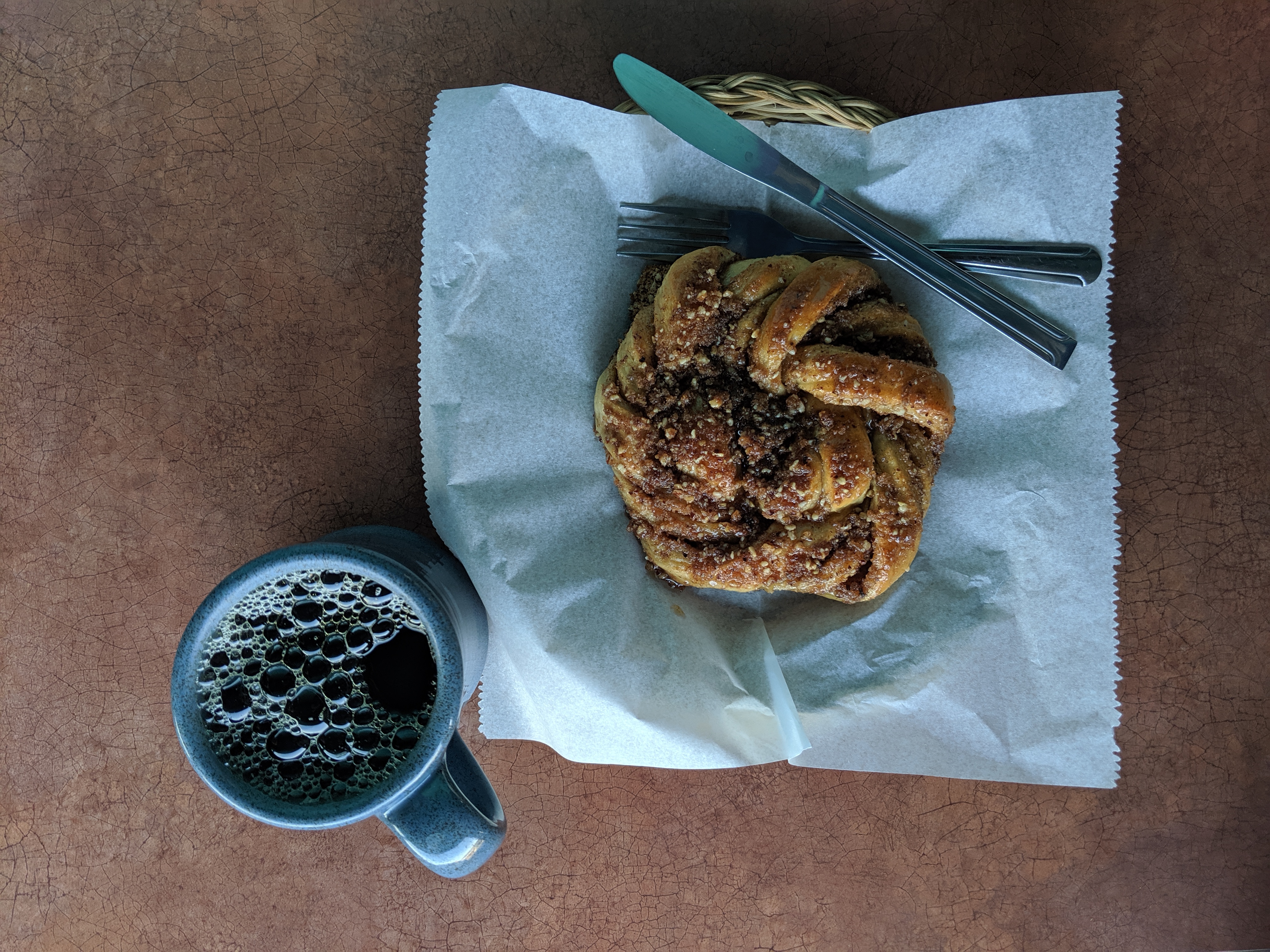
I had read about a popular breakfast spot in Twisp called Cinnamon Twisp. Most cyclists come here for their famous cinnamon roll- the Cinnamon Twisp. After checking out of the motel, I saw where Matthew was along his route via RoadID and drove off.
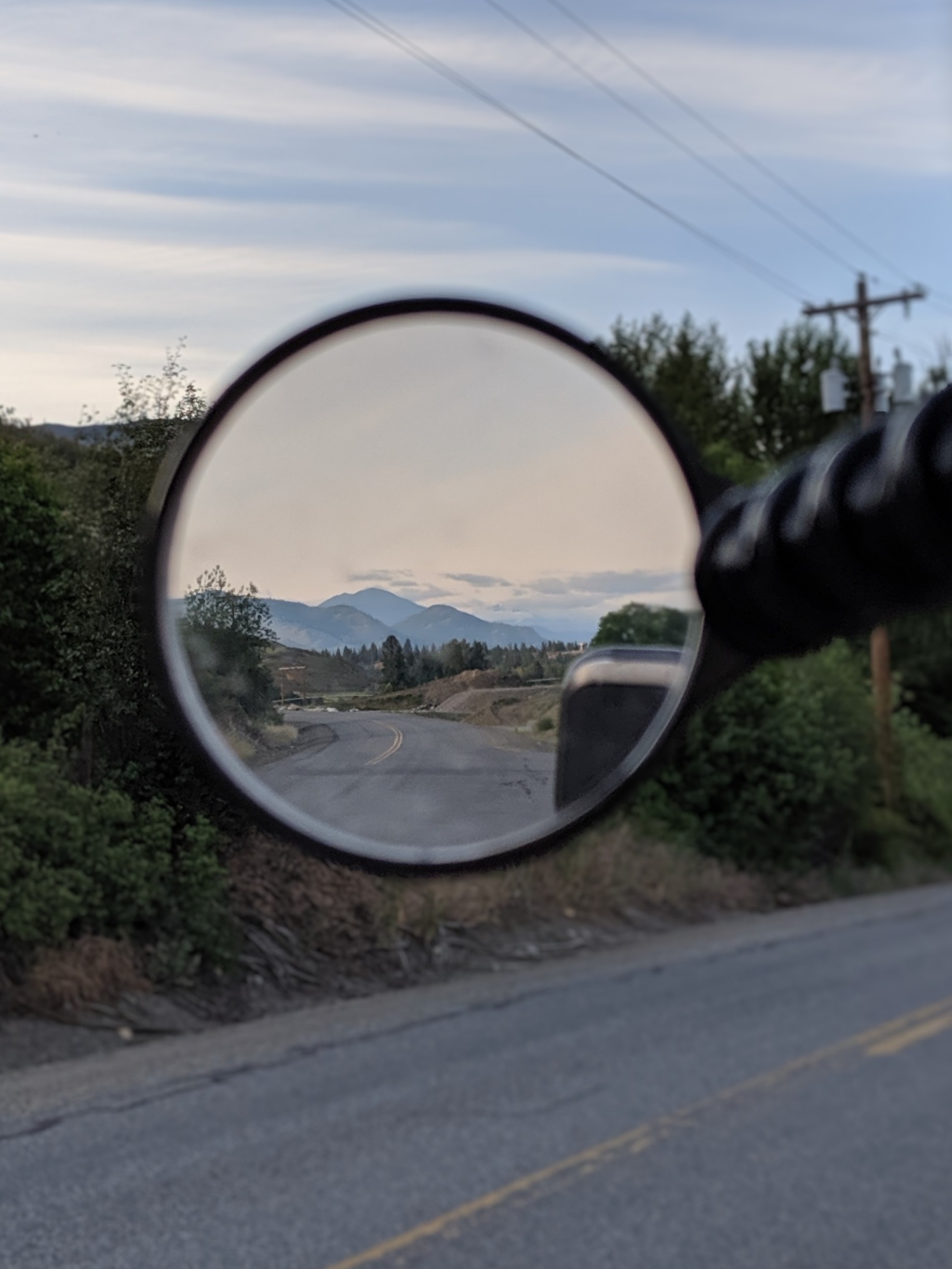
The beginning of the route was quiet and very idyllic. Driving along the empty back roads that snaked around farmland was peaceful- I could imagine it would be better by bike. I saw Matthew up ahead and stopped several times for pictures.
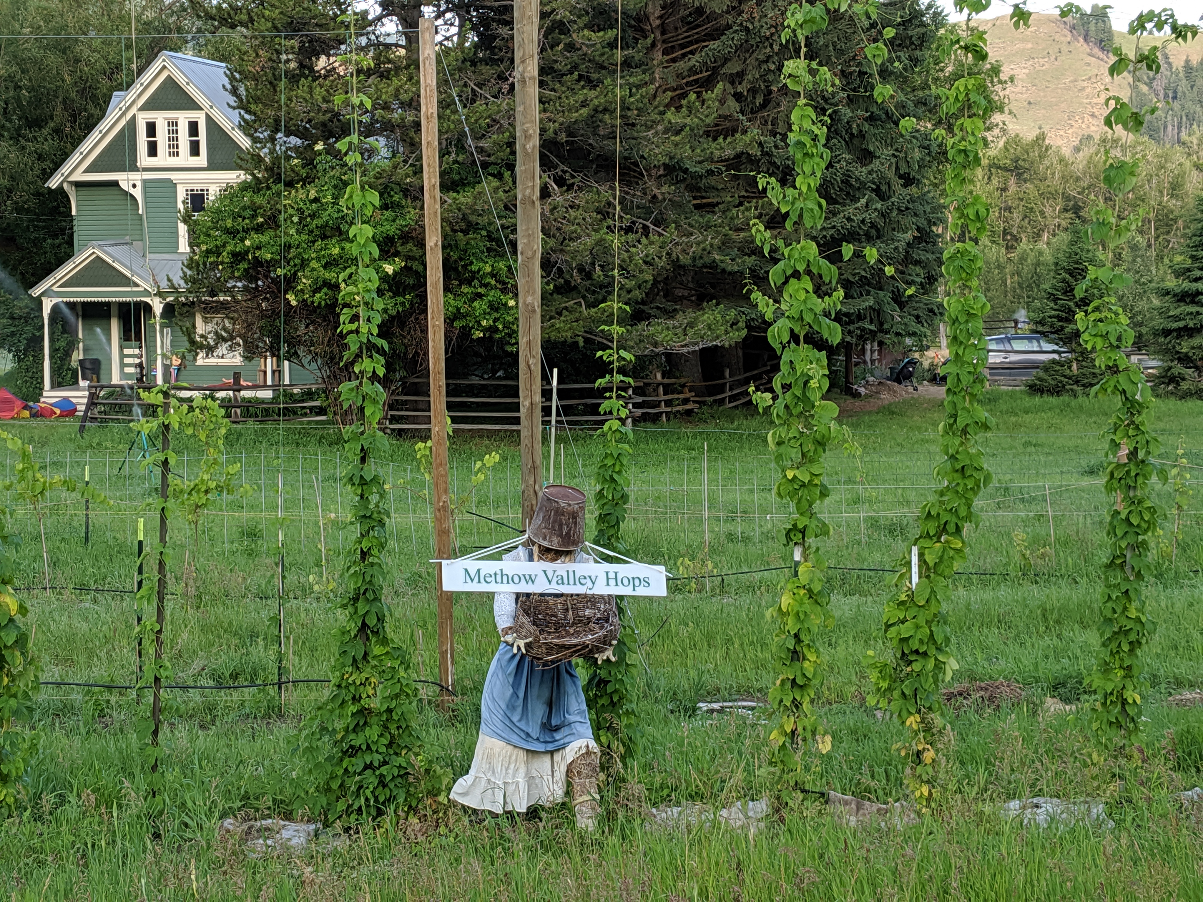
Out of all of the small towns we’ve seen throughout Washington so far, we both agree that Twisp is in our top two favorites. It’s small enough that you can feel the community bond within each local shop you enter, but not so small that your options in sites/scenery/entertainment feel significantly restricted. It’s clearly an outdoor community; we’ve never seen so many lean and fit retired folks in one spot like this. Each person that entered the coffee shop had on hiking or biking clothes as they updated the baker or cashier on their home lives.
The Cinnamon Twisp did not disappoint. We decided to split one. Matthew didn’t want to eat anything too large before his lengthy ride. He decided to take an alternate route he found on Ride With GPS as a mean to avoid another mountain pass.
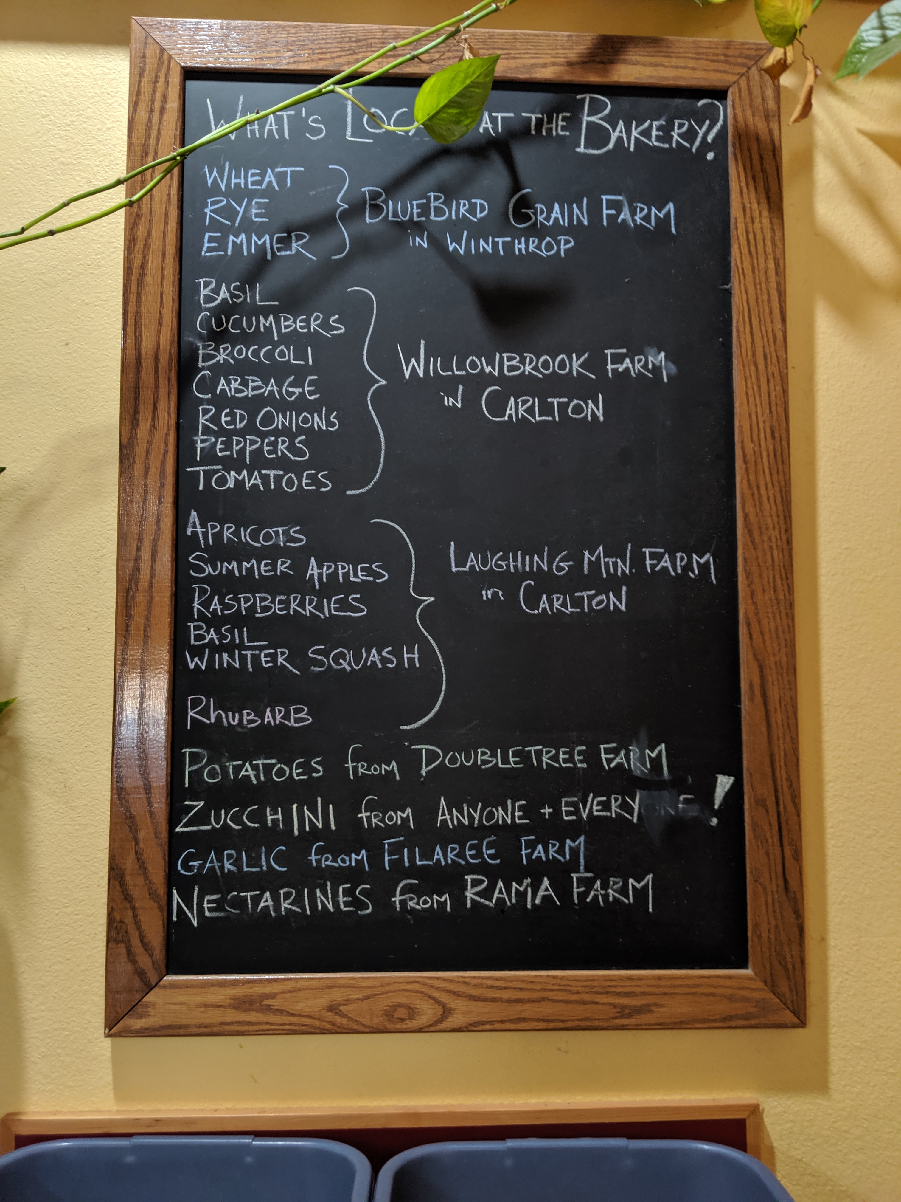
Shortly after Matthew left, he called me to inform me of a farmer’s market he rode past. We’re suckers for local produce and baked goods, so I ambled my way over there and met more locals.
Among the locals was a group of individuals maybe in their 60s in bicycle gear. I asked if they were touring. They told me that each Saturday they ride 30 miles into town for the farmer’s market. Their faces lit up when I explained what Matthew and I were doing. None of them have toured across the country, but they have biked across Washington state. The one female in the group recommended that I purchase the local nectarines for Matthew; they use it as their fuel to ride back home.
After buying some fruit, I got back on the road and followed Matthew’s route. At first I thought it was STUNNING.
We really lucked out in this alternate route!
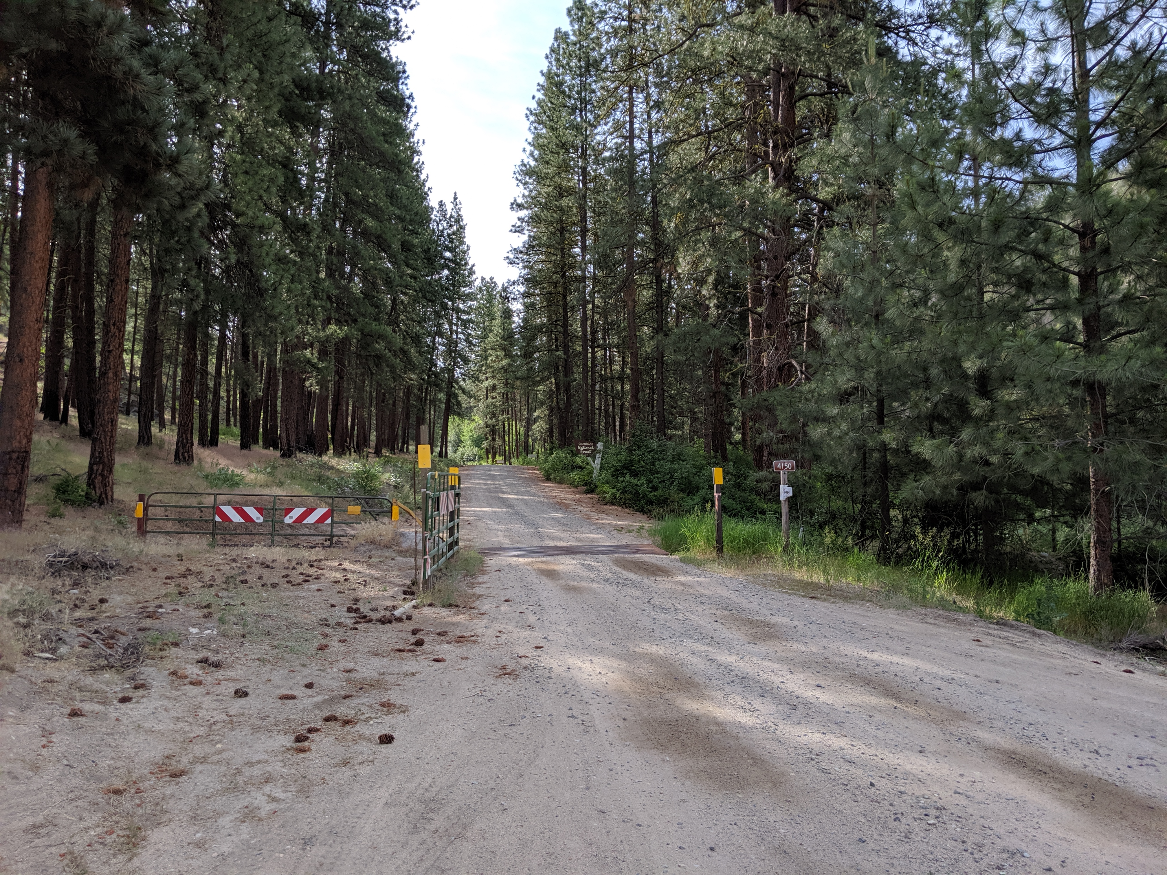
Soon the road went from paved to gravel. Then I noticed a sign reading “WARNING: You are entering primitive road.”
That doesn’t sound great…
The road narrowed and widened inconsistently. Patches of deep gravel had my car swerving occasionally, I had to drop it into low gear. There was no way Matthew could be riding on these roads! The only good thing about this was no other car was in sight. Probably because no one else would be crazy (or dumb) enough to take this route.
I saw what looked like fresh bike tire tracks along the gravel. The tracks were all over the place. I wasn’t sure if Matthew was skidding around or if he was trying to avoid deeper patches of gravel. Then my phone rang. It was Matthew.
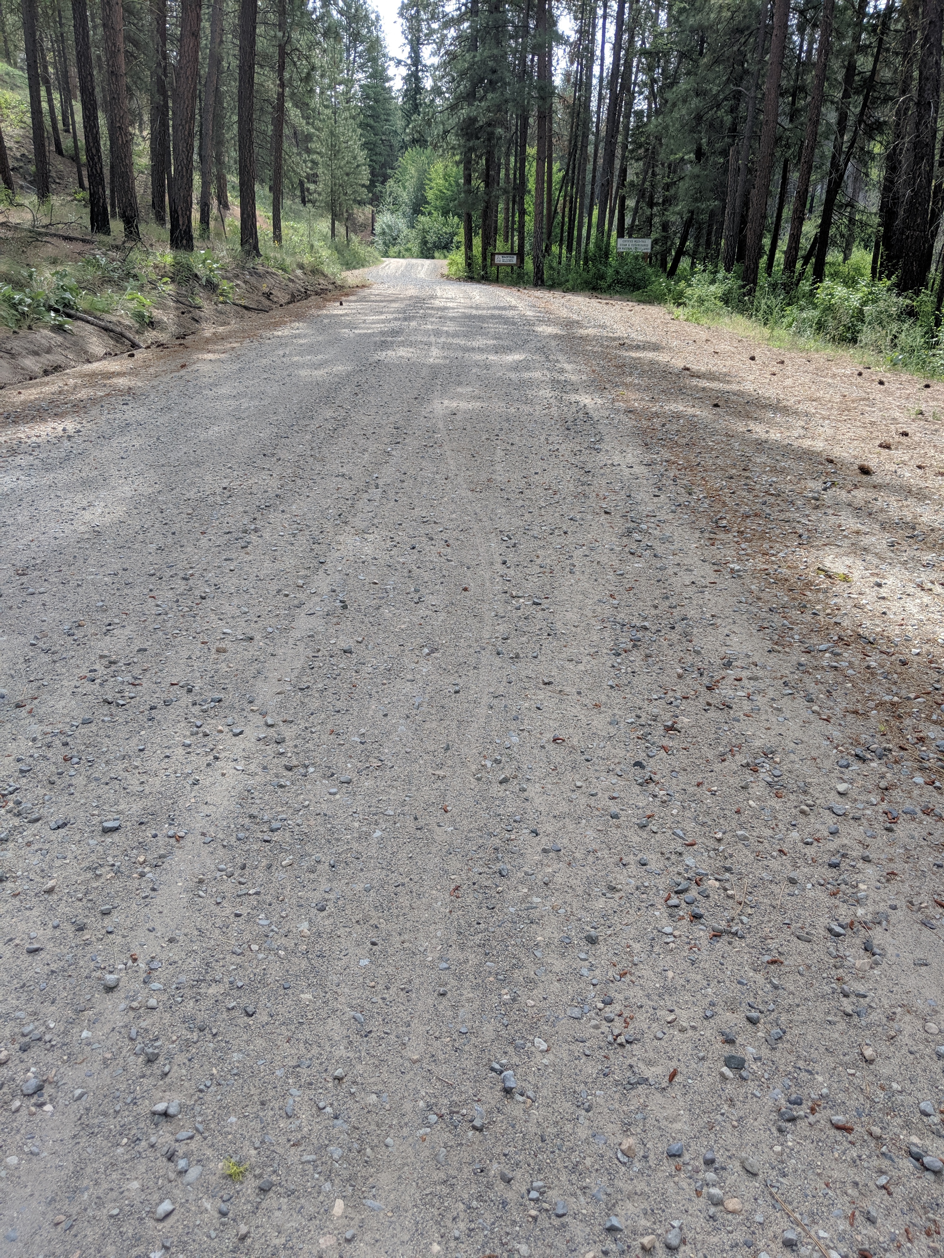
Can you find the fresh bike tracks?
“Lauren. DO NOT take this route! Turn around!!”
“Are you alright? How are you even cycling this route? Why do I need to turn around?”
“I have no idea where I am, other than the middle of nowhere. The road is closed to cars- a lot of trees from last year’s fire are burnt down and at risk of falling. You need to turn around!”
Trying not to freak out about my husband’s wilderness whereabouts, I turned around and took another route that would loop around and hopefully meet him on the other side. He lost service, so I could no longer see exactly where he was. It would only show me the location where he last called me.
I continued to use this alternate route on Ride with GPS as my key. If I could just get back onto this route from highway 20, then I could follow it as far as the roads would let me and zero in on Matthew.
Who would ever RIDE this route?? Did the person who created this even test it out? Are we the beta testers?
I wound up on the side of a small mountain when I heard the dinging indicator on Ride with GPS.
“Turn left.”
There was no left. Why would she want me to turn left? I was reminded of the episode of The Office, when Michael did exactly as his GPS instructed him to and he ended up careening into a lake.
After turning around, I parked on the side of the road to scout out this elusive left turn. It looked like a gravel driveway with a large gate blocking off public access. I wanted to laugh, but the fact that both Matthew and I had no clue where he was with no access to communication sort of stifled the laughter at the moment. I wish I had taken a picture.
Oh yeah, and according to Janet, this was cougar country.
One nice thing about Ride with GPS is that it leaves a red line to show where you have navigated already while still showing the blue line of the planned route. I saw that I had nearly closed the gap from where Matthew left off- at least 5 miles of unaccessible roads were between the two of us.
Looking at a google maps, I could see where an old highway intersected part of this nightmarish alternate route. I figured Matthew would take the opportunity to ditch the alternate route and hop on the old highway.
After turning my car around, I made my way towards the old highway. It only took 15 miles until I found Matthew. Never have I been so happy to see an obnoxiously bright orange vest and American flag combo before!
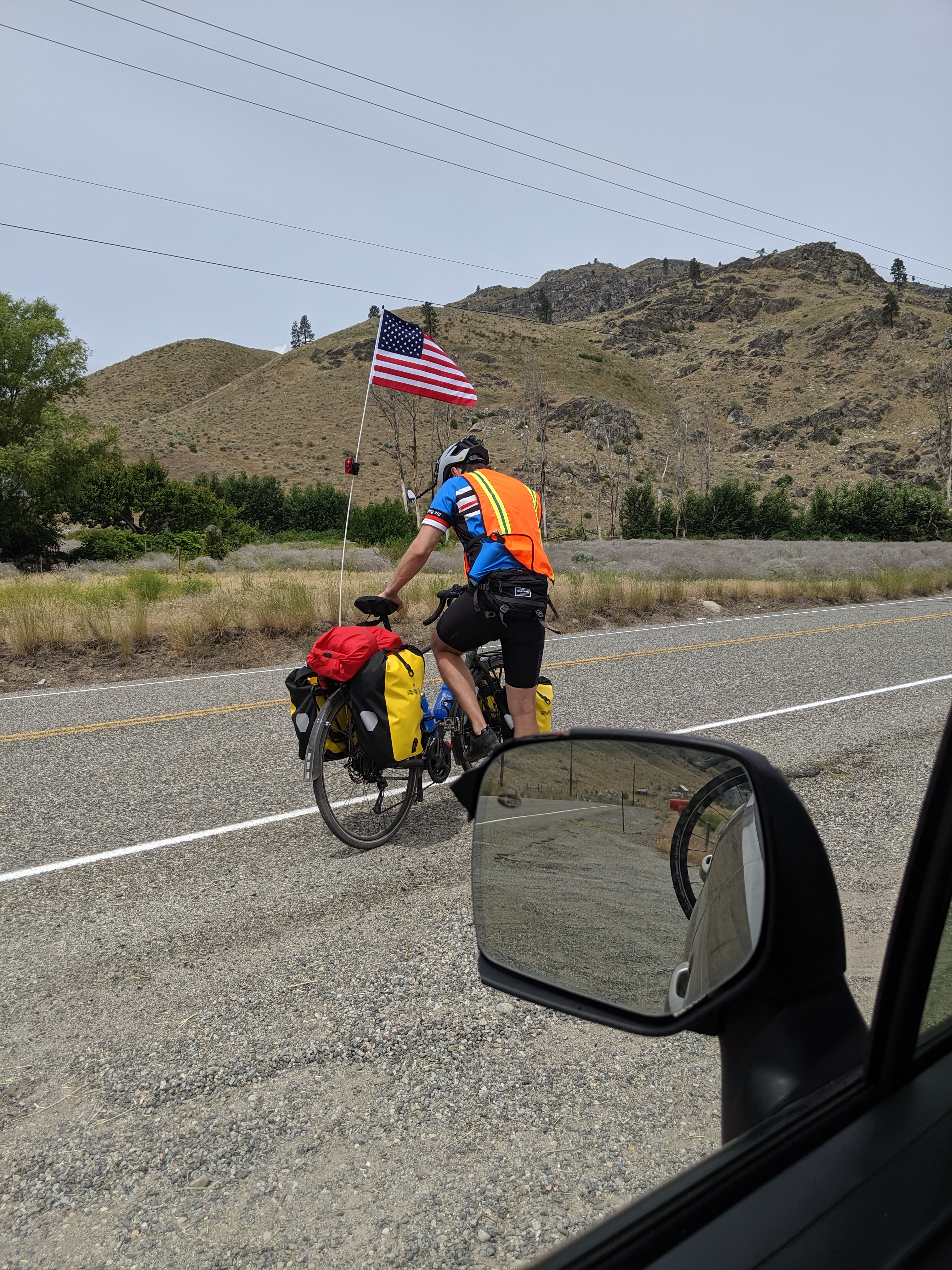
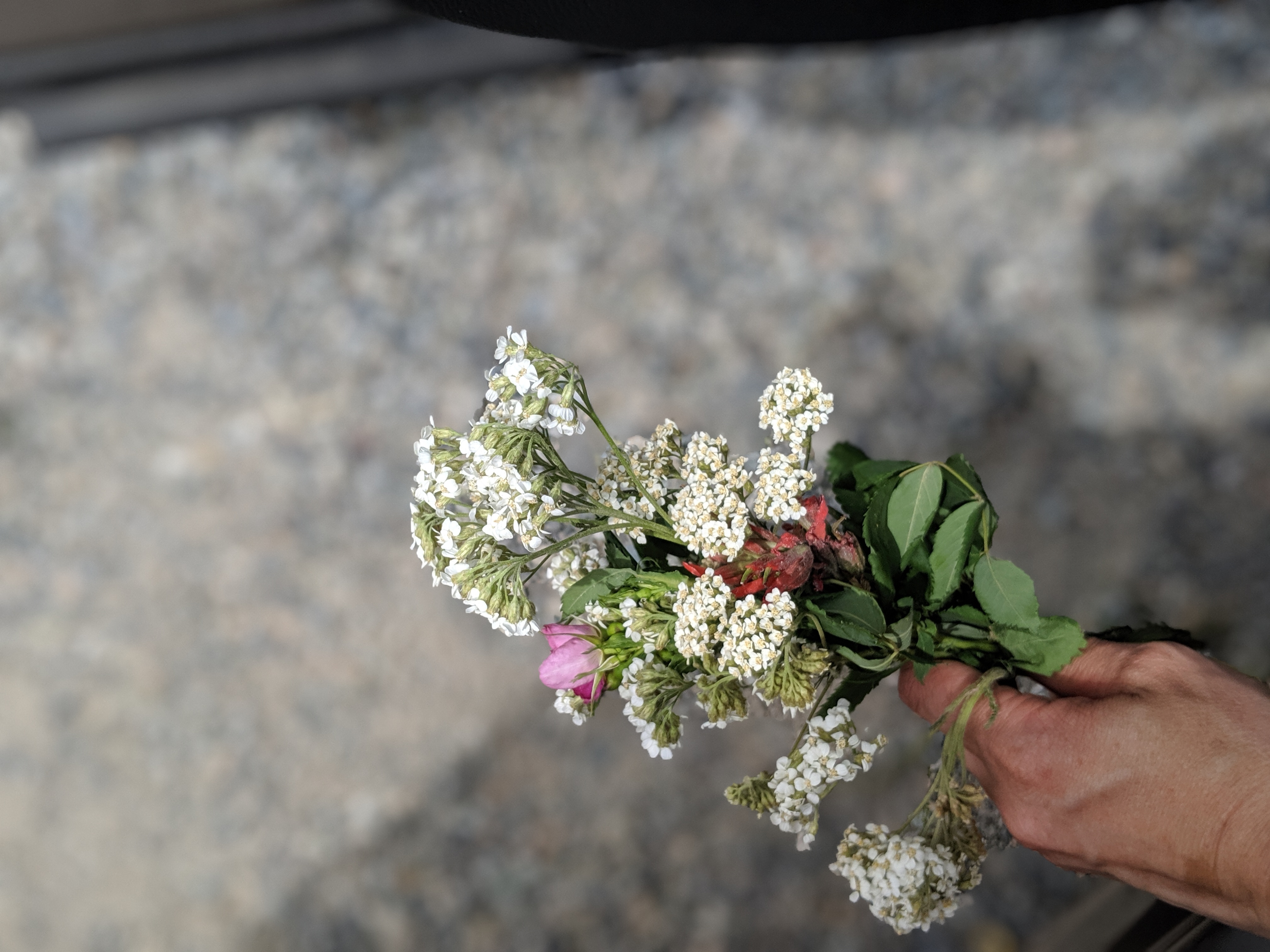
Even after everything Matthew had been through, he still managed to stop and pick flowers for me. He’s slowly adopting my language on this journey.
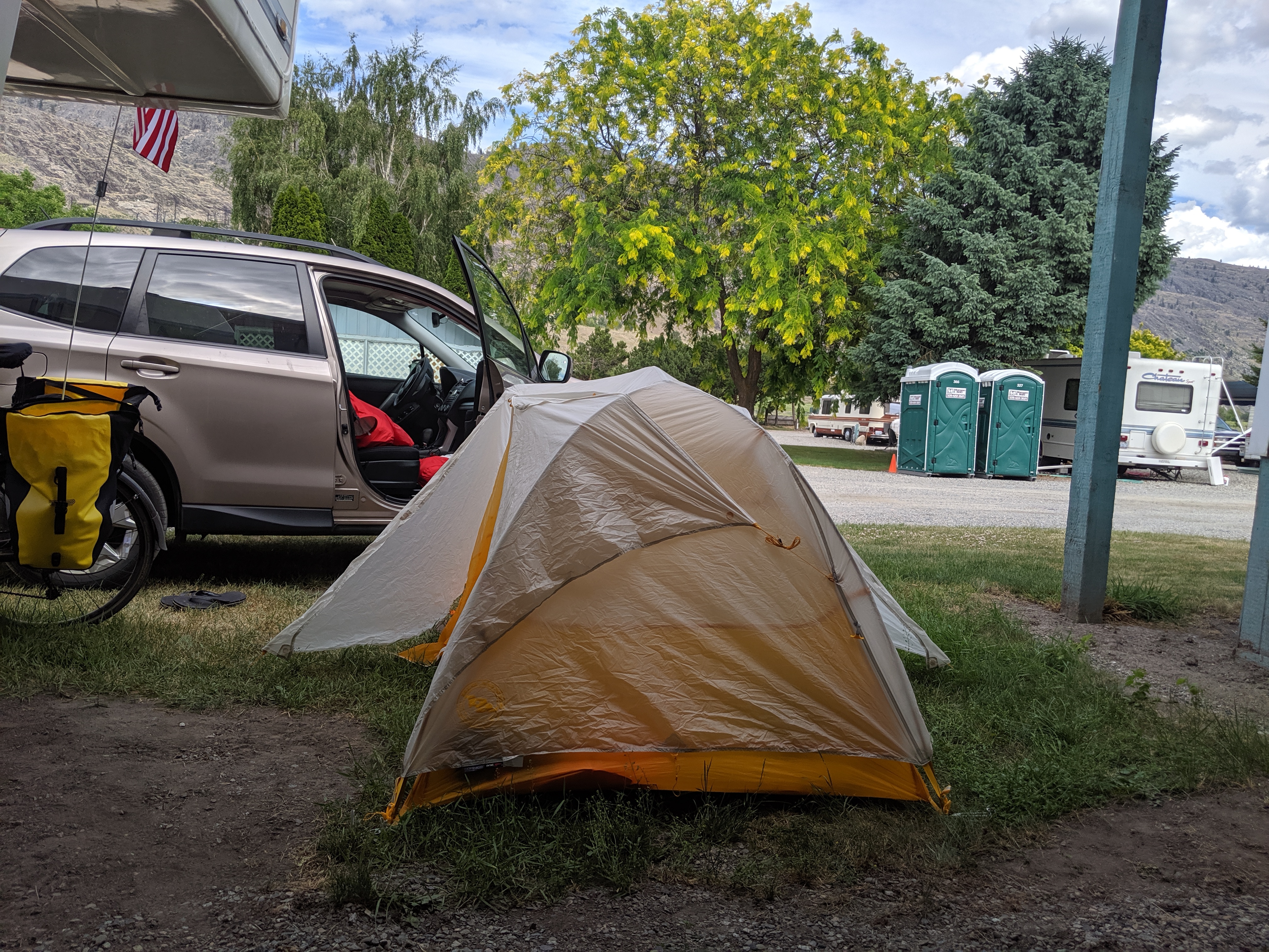
We celebrated life with snacks and a long break off the side of the road and I heard his battle stories, including the herd of cattle he had to ride through! Once he was rested and ready to take off, I left in search of a campsite. I found an RV campsite owned by a retired logger and his wife. The camp grounds were actually being torn up for sewage, but they allowed me to set up our tent in a small plot of land in front of the owner’s camper.
As I was setting up the tend, a shirtless man with long, tangled hair walked up to me with his dog at his side.
“Have you been here before?”
“No, can’t say I have! My husband is biking across the country, we’re just arriving here today. I’m setting up camp while he pedals on over,” I explained.
“He’s WHAT? WOW. JUST WOW. Man… Oh maaaaaaaaaan that’s amazing. You two are seeing the country together like that?”
“Yep!”
“This is incredible. I’ve never heard anything like that, man. My head can’t handle this. I hope to meet your husband when he arrives. My name is Sparky.”
Sparky looked like he had seem some better days, but it was pretty great to see some form of renewed excitement bubble up in him as we discussed our journey.
It took Matthew several hours to bike into the RV campsite. He looked worse than he did while cycling over the mountain passes! I actually became worried for him. If I had sneezed in his direction he likely would have toppled over and made no attempt to get back up.
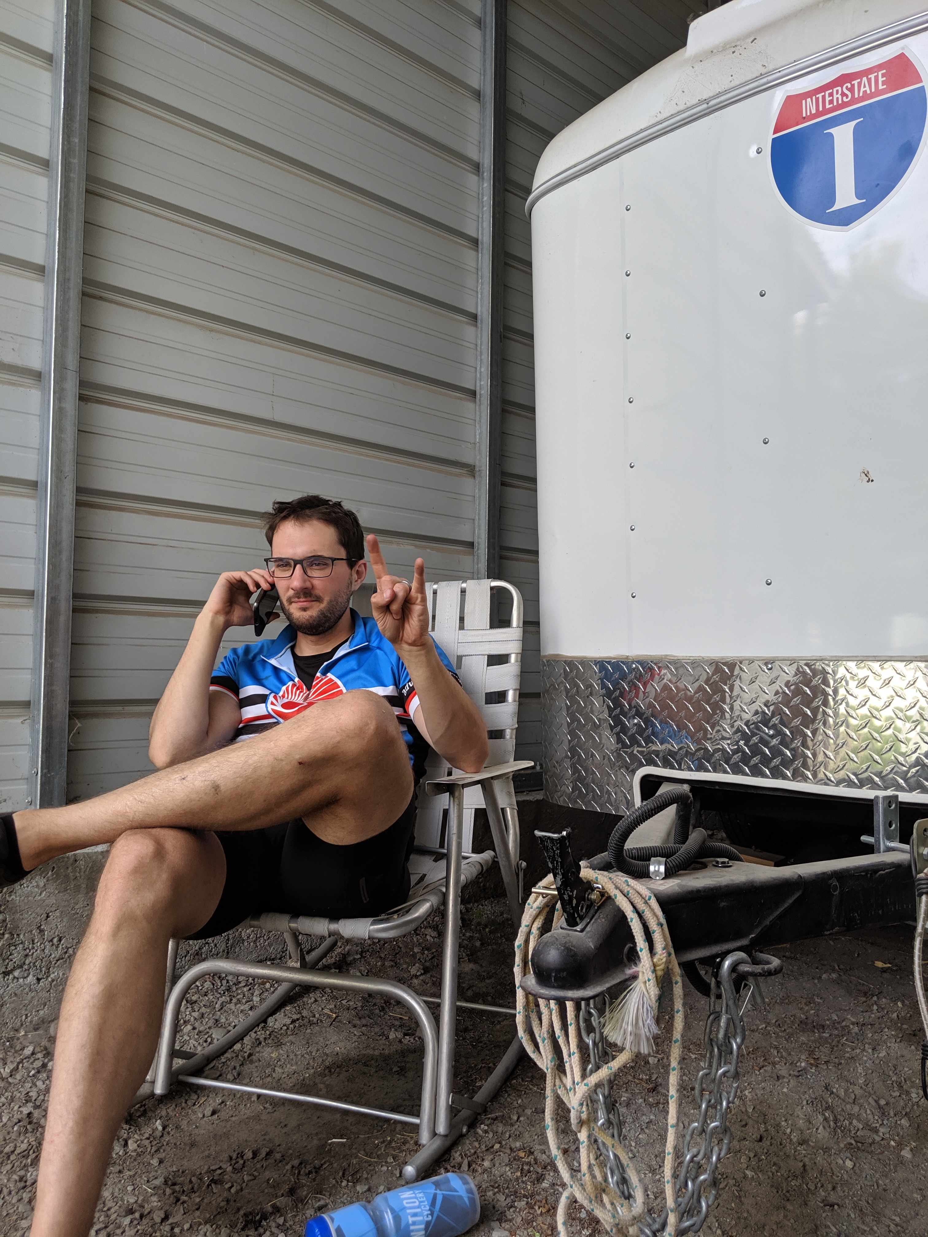
Slowly coming back to life
After resting, eating, and hydrating, life started to reappear in his eyes. We met and had wonderful conversations with several people who were either temporarily camping or living long-term in their RV. One man was a trucker.
“These roads aren’t made for bikes! I don’t know why anyone would try to ride a bike along these highways. Not to mention the bears. If you want, I can give you Colt-45 pistol,” he offered Matthew. We kindly turned it down.
After talking for around an hour, we decided to call it a night. Matthew and I slept well under the stars that night and he was able to start the next ride around 6am.
As I packed camp, Sparky approached me again.
“Did your husband leave already?”
“Oh yeah, Sparky. I’m so sorry you two never got the chance to talk!”
He looked disappointed. “Could you tell him something for me?”
“Of course!”
“You tell him that I thought about what you told me last night. I thought about him. You tell him that he has inspired me to do something I’ve been wanting to do my whole life, but never thought I could. Could you tell him that for me, please? Also, you have a beautiful smile.”
Before I had a chance to ask him about his goals, he turned around and walked away. Sparky, we hope that you find exactly what you’re looking for.
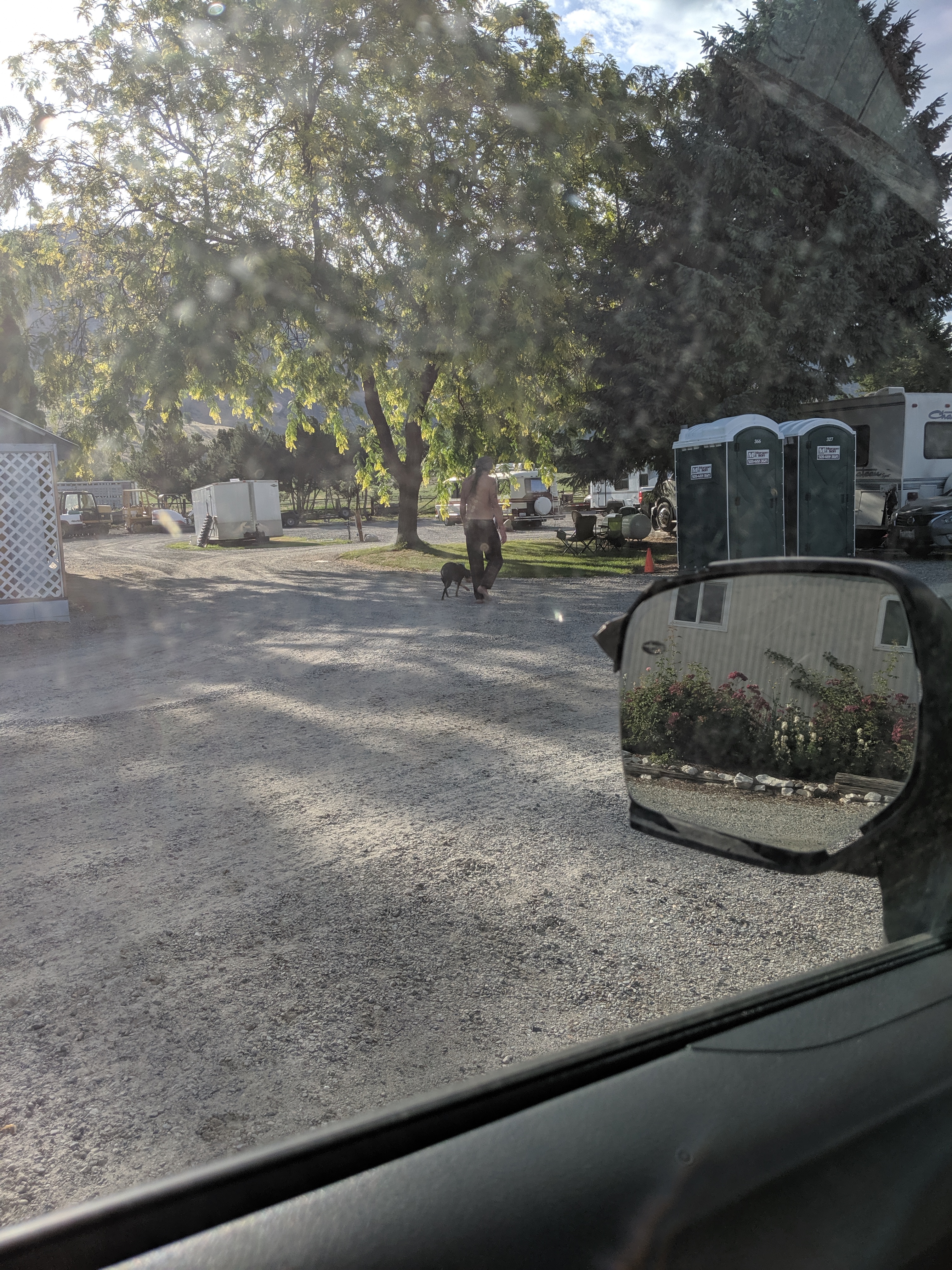
Sparky walking away
